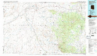
1986 Map of Rock Point
USGS Topo · Published 1987About this map
Monument Valley and Comb Ridge define the northern reaches of this high-desert landscape, located within the Navajo Indian Reservation. This mid-1980s data highlights the remote geography of the Four Corners area, where US Highway 160 and US Highway 191 serve as the primary lifelines connecting scattered settlements like Dennehotso and Mexican Water. The map reveals a history of resource extraction through the presence of the Monument No 2 Mine and the Rattlesnake Mine, while the drainage of Chinle Wash and Lukachukai Creek illustrates the complex hydrology of the Carrizo Mountains. From the heights of Carson Mesa to the trading posts at Rock Point, the survey documents a region where traditional land use and industrial exploration meet across the Dibe Chaa Valley.
Find a feature on this map
43 named features on this map. Tap any name to fly to it.
Don’t see what you’re looking for? This feature index may not catch every label — zoom into the map to look around manually.
Map Details
Editions of this 1986 Rock Point Map
2 editions found
Other maps of this area

1883 · Marsh Pass
USGS Topo · 1:250,000

1886 · Henry Mountains
USGS Topo · 1:250,000

1886 · Abajo
USGS Topo · 1:250,000

1889 · Chaco
USGS Topo · 1:250,000

1892 · Marsh Pass
USGS Topo · 1:250,000

1892 · Abajo
USGS Topo · 1:250,000

1892 · Henry Mountains
USGS Topo · 1:250,000

1892 · Chaco
USGS Topo · 1:250,000

1892 · Canyon De Chelly
USGS Topo · 1:250,000

1893 · Abajo
USGS Topo · 1:250,000