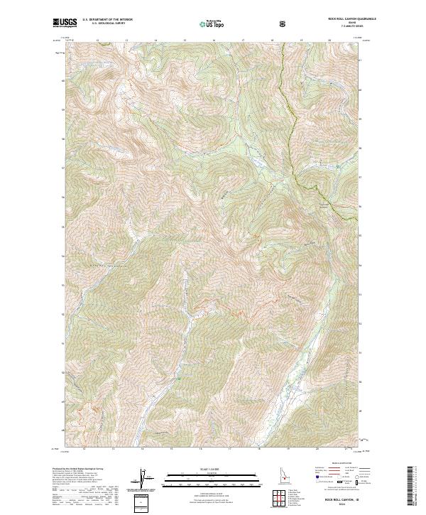
2024 Map of Rock Roll Canyon
USGS Topo · Published 2024About this map
The high alpine intersection of the Boulder Mountains and Pioneer Mountains dominates this recent survey of the Idaho interior. This area serves as a significant hydrological divide, where the East Fork North Fork Big Wood River begins its descent through the Hemingway-Boulders Wilderness. The map traces several vital high-altitude transit points, most notably Trail Creek Summit, where Trail Creek Rd provides a primary route across the rugged divide separating the Sawtooth National Forest from the Challis National Forest. A network of drainage systems, including Rock Roll Canyon and Neal Canyon, underscores the complex vertical relief of the territory. The presence of Lake Or Lakes and various gulches like Steep Gulch and Basin Gulch highlights the glacial and erosional forces that have shaped this high-country landscape, which remains largely defined by federal wilderness and forest management boundaries.
Find a feature on this map
39 named features on this map. Tap any name to fly to it.
Don’t see what you’re looking for? This feature index may not catch every label — zoom into the map to look around manually.
Map Details
Editions of this 2024 Rock Roll Canyon Map
This is the sole edition of this map. No revisions or reprints were ever made.
Other maps of this area

1895 · Hailey
USGS Topo · 1:125,000

1897 · Hailey
USGS Topo · 1:125,000

1955 · Hailey
USGS Topo · 1:250,000

1959 · Hailey
USGS Topo · 1:250,000

1962 · Hailey
USGS Topo · 1:250,000
1967 · Meridian Peak
USGS Topo · 1:24,000

1967 · Rock Roll Canyon
USGS Topo · 1:24,000
1967 · Herd Peak
USGS Topo · 1:24,000

1967 · Sun Valley
USGS Topo · 1:24,000
1967 · Hyndman Peak
USGS Topo · 1:24,000