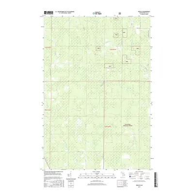
2017 Map of Rock SE
USGS Topo · Published 2017About this map
Hiawatha National Forest lands dominate this portion of Delta County, characterized by a complex network of forest roads and river systems. The Rapid River and Tacoosh River wind through the township, providing the primary drainage for this densely wooded region. Local transport is defined by forest service routes like Engineer Rd and Osier 40th Rd, which reflect the area's history of timber management and rural access. Evidence of older infrastructure remains visible through labels such as Old M 35, while landmarks like Church P.1 Rd suggest historical community centers within the forest. Smaller tributaries, including Boudreau Cr and Inman Cr, carve through the terrain, illustrating the intricate hydrology of the Michigan Upper Peninsula.
Find a feature on this map
26 named features on this map. Tap any name to fly to it.
Don’t see what you’re looking for? This feature index may not catch every label — zoom into the map to look around manually.
Map Details
Editions of this 2017 Rock SE Map
This is the sole edition of this map. No revisions or reprints were ever made.
Other maps of this area

1932 · Gladstone NE
USGS Topo · 1:31,680

1932 · Rock SW
USGS Topo · 1:31,680

1932 · Trenary SW
USGS Topo · 1:31,680

1932 · Rock NE
USGS Topo · 1:31,680

1932 · Rapid River NW
USGS Topo · 1:31,680

1932 · Rock SE
USGS Topo · 1:31,680

1932 · Rock NW
USGS Topo · 1:31,680

1932 · Gladstone NW
USGS Topo · 1:31,680

1950 · Gladstone NW
USGS Topo · 1:31,680

1954 · Escanaba
USGS Topo · 1:250,000