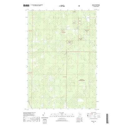
2019 Map of Rock SE
USGS Topo · Published 2019About this map
Hiawatha National Forest dominates the landscape of this portion of Delta County, Michigan, defining a region where dense woodland and complex river systems meet. The drainage pattern is led by the south-flowing Rapid River and the Tacoosh River, which carve through the terrain alongside smaller tributaries like Boudreau Cr and Elm Cr. This 2019 survey illustrates the modern intersection of conservation land and rural access, as seen through the grid of service roads and local routes that penetrate the forest. Features such as Engineer Rd, Church P 1 Rd, and Osier 40th Rd provide access to the interior, while the presence of Inman Cr and low-lying wetlands suggests a landscape that has remained largely natural and undeveloped, prioritized for timber and recreation within the national forest system.
Find a feature on this map
26 named features on this map. Tap any name to fly to it.
Don’t see what you’re looking for? This feature index may not catch every label — zoom into the map to look around manually.
Map Details
Editions of this 2019 Rock SE Map
This is the sole edition of this map. No revisions or reprints were ever made.
Other maps of this area

1932 · Gladstone NE
USGS Topo · 1:31,680

1932 · Rock SW
USGS Topo · 1:31,680

1932 · Trenary SW
USGS Topo · 1:31,680

1932 · Rock NE
USGS Topo · 1:31,680

1932 · Rapid River NW
USGS Topo · 1:31,680

1932 · Rock SE
USGS Topo · 1:31,680

1932 · Rock NW
USGS Topo · 1:31,680

1932 · Gladstone NW
USGS Topo · 1:31,680

1950 · Gladstone NW
USGS Topo · 1:31,680

1954 · Escanaba
USGS Topo · 1:250,000