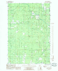
1985 Map of Rock SE
USGS Topo · Published 1985About this map
Clearman Camp and the small settlement of Osier highlight a landscape deeply tied to the timber and transit history of Delta County during the mid-1980s. This survey by the U.S. Geological Survey and the Michigan Department of Natural Resources shows the meeting point of the Escanaba River State Forest and the Hiawatha National Forest. The map documents a complex drainage system defined by the Rapid River and the Tacoosh River, alongside smaller tributaries like Elm Creek and Inman Creek.
Find a feature on this map
17 named features on this map. Tap any name to fly to it.
Don’t see what you’re looking for? This feature index may not catch every label — zoom into the map to look around manually.
Map Details
Editions of this 1985 Rock SE Map
This is the sole edition of this map. No revisions or reprints were ever made.
Other maps of this area

1932 · Gladstone NE
USGS Topo · 1:31,680

1932 · Rock SW
USGS Topo · 1:31,680

1932 · Trenary SW
USGS Topo · 1:31,680

1932 · Rock NE
USGS Topo · 1:31,680

1932 · Rapid River NW
USGS Topo · 1:31,680

1932 · Rock SE
USGS Topo · 1:31,680

1932 · Rock NW
USGS Topo · 1:31,680

1932 · Gladstone NW
USGS Topo · 1:31,680

1950 · Gladstone NW
USGS Topo · 1:31,680

1954 · Escanaba
USGS Topo · 1:250,000