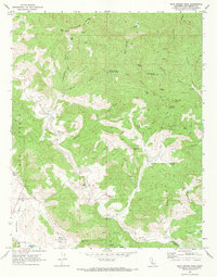
1969 Map of Rock Spring Peak
USGS Topo · Published 1973About this map
The San Andreas Rift Zone dominates the southwestern portion of this San Benito County landscape, carving the distinct corridor of Bitterwater Valley. This tectonic boundary shapes the local geography, placing the Bitterwater-Tully Sch and Bitterwater Cem near the shifting ground of the rift. The area is defined by ranching and water management in a semi-arid environment, evidenced by isolated settlements like the Lew Smith Ranch and Morellini.
Find a feature on this map
43 named features on this map. Tap any name to fly to it.
Don’t see what you’re looking for? This feature index may not catch every label — zoom into the map to look around manually.
Map Details
Editions of this 1969 Rock Spring Peak Map
This is the sole edition of this map. No revisions or reprints were ever made.
Other maps of this area

1913 · Panoche
USGS Topo · 1:125,000

1915 · Priest Valley
USGS Topo · 1:125,000

1919 · San Benito
USGS Topo · 1:62,500

1921 · Metz
USGS Topo · 1:62,500

1931 · San Benito
USGS Topo · 1:62,500

1940 · Metz
USGS Topo · 1:62,500

1940 · San Benito
USGS Topo · 1:62,500

1943 · Hernandez Valley
USGS Topo · 1:62,500

1944 · Hernandez Valley
USGS Topo · 1:62,500

1944 · Panoche Valley
USGS Topo · 1:62,500