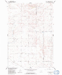
1956 Map of Rock Spring
USGS Topo · Published 1992About this map
Stillwater and Yellowstone Counties meet in this high prairie landscape, where the vast Lake Basin depression dominates the southern reaches. Mapped in the mid-1950s as part of the Missouri River Basin development program, the area is defined by a drainage network of intermittent streams like South Comanche Creek and Brown Creek. Human presence is sparse but specific to the era's ranching and aviation needs, notably marked by the Melby Hangar and the namesake Rock Spring.
Find a feature on this map
10 named features on this map. Tap any name to fly to it.
Don’t see what you’re looking for? This feature index may not catch every label — zoom into the map to look around manually.
Map Details
Editions of this 1956 Rock Spring Map
2 editions found
Other maps of this area

1889 · Big Snowy Mountain
USGS Topo · 1:250,000

1892 · Stillwater
USGS Topo · 1:125,000

1893 · Big Snowy Mountain
USGS Topo · 1:250,000

1954 · Billings
USGS Topo · 1:250,000

1954 · Roundup
USGS Topo · 1:250,000

1956 · Comanche
USGS Topo · 1:24,000

1956 · Hunter Lake
USGS Topo · 1:24,000

1956 · Molt
USGS Topo · 1:24,000

1956 · Wheat Basin
USGS Topo · 1:24,000

1956 · Rock Spring
USGS Topo · 1:24,000