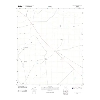
2010 Map of Rock Tank Draw
USGS Topo · Published 2010About this map
Lordsburg Mesa and the surrounding high desert of Hidalgo County dominate this 2010 topographic record, showing a landscape defined by water management and ranching. The area is marked by several ranching landmarks including the Raymond Fuller Ranch, Backer Ranch, and isolated sites like the Burtch Windmill. To combat the erratic nature of desert drainage, a series of water control structures are visible, such as Stanford Detention Dam Number Two and Stanford Detention Dam Number Three. These features sit alongside natural dry washes like Thompson Draw and Dagger Draw. The presence of the Rock Tank and several named windmills highlights the critical infrastructure required for survival and industry in this arid region, where the terrain shifts from the Black Hills in the north to the Summit Hills in the south.
Find a feature on this map
24 named features on this map. Tap any name to fly to it.
Don’t see what you’re looking for? This feature index may not catch every label — zoom into the map to look around manually.
Map Details
Editions of this 2010 Rock Tank Draw Map
This is the sole edition of this map. No revisions or reprints were ever made.
Other maps of this area

1917 · San Simon
USGS Topo · 1:125,000

1926 · Orange Butte
USGS Topo · 1:62,500

1950 · San Simon
USGS Topo · 1:62,500

1951 · San Simon
USGS Topo · 1:62,500

1954 · Silver City
USGS Topo · 1:250,000

1958 · Silver City
USGS Topo · 1:250,000

1959 · Canador Peak
USGS Topo · 1:62,500

1960 · Duncan
USGS Topo · 1:62,500

1962 · Silver City
USGS Topo · 1:250,000
1962 · San Simon
USGS Topo · 1:62,500