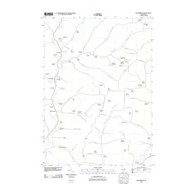
2010 Map of Rockbridge
USGS Topo · Published 2010About this map
Dairy and stock farming define the character of this Richland County landscape, where the Pine River and its numerous tributaries have carved a complex network of valleys and ridges. The settlement at Hub City serves as a northern anchor, while Rockbridge and Buck Creek mark the southern stretches of the river valley. The map reveals an intensive agricultural economy through dozens of named family operations, such as Pleasant View Stock and Dairy Farm and the Riverside Stock Farm.
Find a feature on this map
103 named features on this map. Tap any name to fly to it.
Don’t see what you’re looking for? This feature index may not catch every label — zoom into the map to look around manually.
Map Details
Editions of this 2010 Rockbridge Map
This is the sole edition of this map. No revisions or reprints were ever made.
Other maps of this area

1905 · Richland Center
USGS Topo · 1:125,000

1927 · Hillsboro
USGS Topo · 1:62,500

1956 · Reedsburg
USGS Topo · 1:62,500

1958 · La Crosse
USGS Topo · 1:250,000

1960 · Richland Center
USGS Topo · 1:62,500

1960 · Plain
USGS Topo · 1:62,500

1961 · La Crosse
USGS Topo · 1:250,000

1965 · La Crosse
USGS Topo · 1:250,000

1966 · Hillsboro
USGS Topo · 1:62,500
1975 · La Valle
USGS Topo · 1:24,000