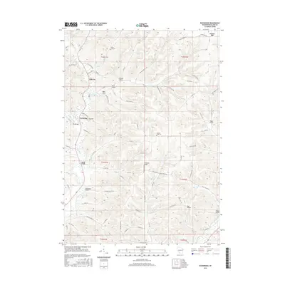
2016 Map of Rockbridge
USGS Topo · Published 2016About this map
The Pine River and its numerous tributaries, including Hawkins Cr and West Pine River, carve a complex network of valleys through this portion of Richland County. Small rural hubs such as Hub City and Rockbridge serve as focal points for a landscape defined by sharp elevation changes and narrow drainage basins like Snow Valley and Ryan Valley. The distribution of Soules Creek Cem, Rockbridge Cem, and Pleasant Ridge Cem reflects the long-standing community centers established along these ridge tops and valley floors.
Find a feature on this map
77 named features on this map. Tap any name to fly to it.
Don’t see what you’re looking for? This feature index may not catch every label — zoom into the map to look around manually.
Map Details
Editions of this 2016 Rockbridge Map
This is the sole edition of this map. No revisions or reprints were ever made.
Other maps of this area

1905 · Richland Center
USGS Topo · 1:125,000

1927 · Hillsboro
USGS Topo · 1:62,500

1956 · Reedsburg
USGS Topo · 1:62,500

1958 · La Crosse
USGS Topo · 1:250,000

1960 · Richland Center
USGS Topo · 1:62,500

1960 · Plain
USGS Topo · 1:62,500

1961 · La Crosse
USGS Topo · 1:250,000

1965 · La Crosse
USGS Topo · 1:250,000

1966 · Hillsboro
USGS Topo · 1:62,500
1975 · La Valle
USGS Topo · 1:24,000