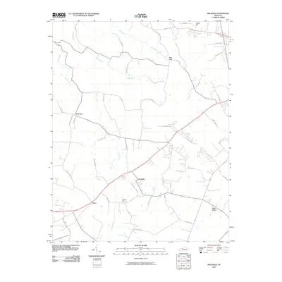
2010 Map of Rockfield
USGS Topo · Published 2010About this map
Rockfield and its neighboring communities in Warren County appear at a time when the agricultural landscape was increasingly intersected by modern transit corridors. Small settlements like Petros and Browning are situated along a network of country roads, reflecting the long-standing rural development pattern of this region southwest of Bowling Green. The terrain is defined by the winding paths of Brush Creek and Chism Creek, while the presence of the Pleasant Hill Cemetery provides a focal point for genealogical interest in the area's local history. To the northeast, the elevation rises toward Briggs Hill, near the communities of Blue Level and Rich Pond, where established land divisions and family-named routes like Hughes Lashlee Rd and Kettlestick Rd illustrate the enduring layout of Kentucky's karst-influenced countryside.
Find a feature on this map
49 named features on this map. Tap any name to fly to it.
Don’t see what you’re looking for? This feature index may not catch every label — zoom into the map to look around manually.
Map Details
Editions of this 2010 Rockfield Map
This is the sole edition of this map. No revisions or reprints were ever made.
Other maps of this area

1914 · Little Muddy
USGS Topo · 1:62,500

1921 · Bowling Green
USGS Topo · 1:62,500

1922 · Brownsville
USGS Topo · 1:62,500

1923 · Bowling Green
USGS Topo · 1:62,500

1923 · Brownsville
USGS Topo · 1:62,500

1951 · Woodburn
USGS Topo · 1:24,000

1951 · Auburn
USGS Topo · 1:24,000

1951 · South Union
USGS Topo · 1:24,000

1952 · Rockfield
USGS Topo · 1:24,000

1954 · Evansville
USGS Topo · 1:250,000