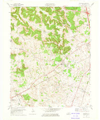
1973 Map of Rockfield
USGS Topo · Published 1974About this map
Rockfield and the surrounding agricultural lands of Warren Co are defined by a complex network of oil extraction and karst topography. The landscape is dotted with numerous Oil Wells, particularly concentrated around the community of Browning and north toward Blue Level. This 1970s survey illustrates a rural economy transitioning from traditional farming toward industrial resource extraction, with the Whitestone Quarry and another large Quarry situated near the headwaters of Salt Lick Creek.
Find a feature on this map
25 named features on this map. Tap any name to fly to it.
Don’t see what you’re looking for? This feature index may not catch every label — zoom into the map to look around manually.
Map Details
Editions of this 1973 Rockfield Map
This is the sole edition of this map. No revisions or reprints were ever made.
Other maps of this area

1914 · Little Muddy
USGS Topo · 1:62,500

1921 · Bowling Green
USGS Topo · 1:62,500

1922 · Brownsville
USGS Topo · 1:62,500

1923 · Bowling Green
USGS Topo · 1:62,500

1923 · Brownsville
USGS Topo · 1:62,500

1951 · Woodburn
USGS Topo · 1:24,000

1951 · Auburn
USGS Topo · 1:24,000

1951 · South Union
USGS Topo · 1:24,000

1952 · Rockfield
USGS Topo · 1:24,000

1954 · Evansville
USGS Topo · 1:250,000