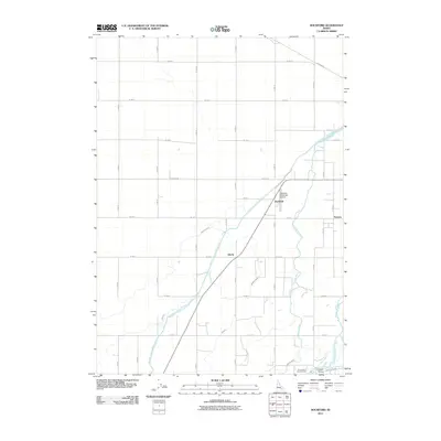
2011 Map of Rockford
USGS Topo · Published 2011About this map
Agricultural life in Bingham County depends on the intricate irrigation networks documented in this study of the eastern Snake River Plain. The landscape is defined by the Aberdeen Springfield Canal and the Peoples Canal, which draw from the Snake River to support the surrounding farmland. These engineered waterways dictate the placement of small rural communities like Rockford, Liberty, and Thomas, each situated along the gravel and paved road grids that divide the territory.
Find a feature on this map
42 named features on this map. Tap any name to fly to it.
Don’t see what you’re looking for? This feature index may not catch every label — zoom into the map to look around manually.
Map Details
Editions of this 2011 Rockford Map
This is the sole edition of this map. No revisions or reprints were ever made.
Other maps of this area

1940 · Blackfoot
USGS Topo · 1:62,500

1943 · Blackfoot
USGS Topo · 1:62,500

1955 · Springfield NW
USGS Topo · 1:24,000

1955 · Baldy Knoll
USGS Topo · 1:24,000

1955 · Rockford
USGS Topo · 1:24,000

1955 · Pingree
USGS Topo · 1:24,000

1955 · Springfield
USGS Topo · 1:24,000

1955 · Idaho Falls
USGS Topo · 1:250,000

1958 · Idaho Falls
USGS Topo · 1:250,000
1971 · Fort Hall
USGS Topo · 1:24,000