
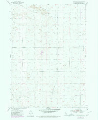
1955 Map of Springfield NW
USGS Topo · Published 1956About this map
Lava flows dominate the northern landscape of this Bingham County territory, reflecting a stark geologic character that dictated early land use. This mid-century survey documents a sparsely populated region where infrastructure was primarily designed for resource access and transit between more established Idaho settlements. The Springfield Taber Road cuts a north-south path through the quadrangle, serving as a primary artery for the scattered ranching and agricultural efforts of the 1950s. Water management is a central theme of the sheet, marked by several wells such as Number 1 Well and a functional Windmill. These features, along with a network of Jeep Trails, highlight the practical challenges of navigating and working the arid, volcanic terrain of the Snake River Plain during this era.
Find a feature on this map
7 named features on this map. Tap any name to fly to it.
Don’t see what you’re looking for? This feature index may not catch every label — zoom into the map to look around manually.
Map Details
Editions of this 1955 Springfield NW Map
2 editions found
Other maps of this area

1955 · Rockford
USGS Topo · 1:24,000

1955 · Pingree
USGS Topo · 1:24,000

1955 · Springfield
USGS Topo · 1:24,000

1955 · Idaho Falls
USGS Topo · 1:250,000

1958 · Idaho Falls
USGS Topo · 1:250,000

1973 · Olsen
USGS Topo · 1:24,000

1973 · Taber
USGS Topo · 1:24,000

1973 · Lava Lake Reservoir
USGS Topo · 1:24,000

1973 · Coffee Point NE
USGS Topo · 1:24,000
1973 · Big Fill Reservoir
USGS Topo · 1:24,000