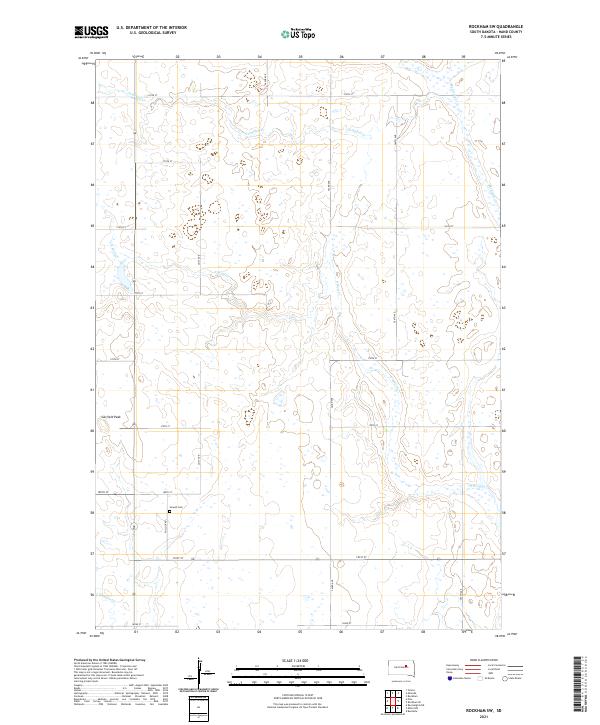
2021 Map of Rockham SW
USGS Topo · Published 2021About this map
Howell Cem provides a focal point for family history and local heritage in this rural section of Hand County. The landscape is defined by a network of drainage ways including Campbell Cr, Medicine Cr, and N Wolf Cr, which meander through the prairie terrain. The most prominent elevation in the area is Garfield Peak, rising above the grid of section lines. The road network, including Pollock RD and numbered routes like 180th St, follows the established Public Land Survey System boundaries, reflecting the enduring legacy of the regional settlement pattern. Small wetlands and intermittent streams such as Shaefer Cr reveal the natural hydrology of the South Dakota plains, where water management and topography dictate the placement of local homesteads and travel routes.
Find a feature on this map
25 named features on this map. Tap any name to fly to it.
Don’t see what you’re looking for? This feature index may not catch every label — zoom into the map to look around manually.
Map Details
Editions of this 2021 Rockham SW Map
This is the sole edition of this map. No revisions or reprints were ever made.
Other maps of this area

1899 · Redfield
USGS Topo · 1:125,000

1951 · Orient
USGS Topo · 1:24,000

1951 · Polo
USGS Topo · 1:24,000

1951 · Ree Heights NE
USGS Topo · 1:24,000

1953 · Huron
USGS Topo · 1:250,000

1954 · Huron
USGS Topo · 1:250,000

1966 · Burdette
USGS Topo · 1:24,000
1966 · Miranda
USGS Topo · 1:24,000
1966 · Rockham SW
USGS Topo · 1:24,000
1966 · Rockham
USGS Topo · 1:24,000