
1951 Map of Ree Heights NE
USGS Topo · Published 1951About this map
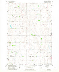
The rolling plains of Hand County, South Dakota, are depicted here in a mid-century landscape defined by rural education and small-scale drainage. This terrain is marked by a network of ephemeral watercourses including the winding path of Lost Creek and the southern flow of Wolf Creek. These seasonal streams shaped the settlement patterns of the early 20th century, where local life centered around the section-line roads and country schoolhouses that anchored the farming community. Map readers can identify specific centers of community life such as Eaton Sch, Haas Sch, and Prairie View Sch, which served the surrounding townships of Florence and Alden. The presence of the Alden Cem provides a genealogical anchor for the area, while the township boundaries of Fairview, Howell, Greenleaf, and Alpha illustrate the formal organization of this prairie landscape.
Find a feature on this map
12 named features on this map. Tap any name to fly to it.
Don’t see what you’re looking for? This feature index may not catch every label — zoom into the map to look around manually.
Map Details
Editions of this 1951 Ree Heights NE Map
This is the sole edition of this map. No revisions or reprints were ever made.
Other maps of this area

1899 · Redfield
USGS Topo · 1:125,000

1949 · Ree Heights NW
USGS Topo · 1:24,000

1950 · Ree Heights SE
USGS Topo · 1:24,000

1950 · Ree Heights
USGS Topo · 1:24,000

1951 · Ree Heights NW
USGS Topo · 1:24,000

1951 · Orient SW
USGS Topo · 1:24,000

1951 · Polo
USGS Topo · 1:24,000

1953 · Huron
USGS Topo · 1:250,000

1954 · Huron
USGS Topo · 1:250,000
1966 · Rockham SW
USGS Topo · 1:24,000