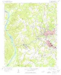
1956 Map of Rockingham
USGS Topo · Published 1977About this map
Rockingham and East Rockingham serve as the industrial and civic core of this North Carolina landscape, where the textile economy is evident in the dense residential clusters of Cordova and West Rockingham. The Pee Dee River defines the western boundary between Richmond and Anson Counties, its course marked by Walls Landing and several gaging stations. The region's transport network is dominated by the Seaboard Air Line railroad, which cuts across the terrain to connect the mills and settlements.
Find a feature on this map
98 named features on this map. Tap any name to fly to it.
Don’t see what you’re looking for? This feature index may not catch every label — zoom into the map to look around manually.
Map Details
Editions of this 1956 Rockingham Map
4 editions found
Other maps of this area

1942 · Troy
USGS Topo · 1:125,000

1942 · Rockingham
USGS Topo · 1:125,000

1949 · Millstone Lake
USGS Topo · 1:24,000

1949 · Ghio
USGS Topo · 1:24,000

1949 · Hamlet
USGS Topo · 1:24,000

1949 · Hamlet
USGS Topo · 1:62,500

1949 · Jackson Springs
USGS Topo · 1:62,500

1953 · Florence
USGS Topo · 1:250,000

1953 · Raleigh
USGS Topo · 1:250,000

1954 · Florence
USGS Topo · 1:250,000