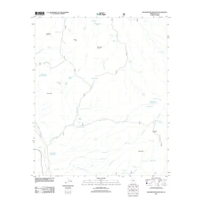
2011 Map of Rockinstraw Mountain
USGS Topo · Published 2011About this map
Richmond Basin and the surrounding high desert of Gila County define this 2011 survey, showing a landscape managed for water through an extensive network of tanks and springs. The geography is anchored by prominent summits such as Rockinstraw Mountain and Granite Peak, while human activity is traced through primitive routes like Shute Springs Rd and Richmond Basin Rd. The reliance on local water sources is evident in the naming of features such as Rockinstraw Tank, Cement Spring, and the uniquely labeled Cherry Horizontal Spring. To the south, Nugget Mesa overlooks the drainage of Rough Canyon, illustrating the high-relief terrain typical of this portion of Arizona. This map serves as a record of the remote infrastructure used for cattle ranching and land management in the early 21st century, from Dry Weather Ford Tank to the hidden Mint Spring.
Find a feature on this map
54 named features on this map. Tap any name to fly to it.
Don’t see what you’re looking for? This feature index may not catch every label — zoom into the map to look around manually.
Map Details
Editions of this 2011 Rockinstraw Mountain Map
This is the sole edition of this map. No revisions or reprints were ever made.
Other maps of this area

1901 · Globe
USGS Topo · 1:62,500

1902 · Globe
USGS Topo · 1:62,500

1922 · Chrysotile
USGS Topo · 1:125,000

1945 · Globe
USGS Topo · 1:24,000

1945 · Inspiration
USGS Topo · 1:24,000

1947 · Inspiration
USGS Topo · 1:24,000

1949 · Rockinstraw Mtn
USGS Topo · 1:62,500

1950 · Rockinstraw Mtn
USGS Topo · 1:62,500

1954 · Mesa
USGS Topo · 1:250,000

1957 · Mesa
USGS Topo · 1:250,000