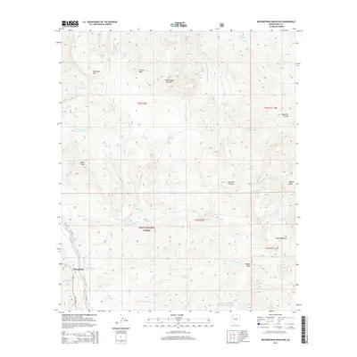
2014 Map of Rockinstraw Mountain
USGS Topo · Published 2014About this map
Wheatfields sits at the southwestern edge of this Gila County terrain, where the Apache Trl and Hicks Rd provide access to the high desert interior. Much of the landscape is dominated by the complex topography of the Tonto National Forest, characterized by numerous peaks such as Rockinstraw Mountain, Redmond Mtn, and Granite Peak. The area is a network of seasonal drainages and essential water sources, including Redmond Wash and Horseshoe Bend Wash, which feed into various tanks like Big Pond Tank and Rockinstraw Tank.
Find a feature on this map
59 named features on this map. Tap any name to fly to it.
Don’t see what you’re looking for? This feature index may not catch every label — zoom into the map to look around manually.
Map Details
Editions of this 2014 Rockinstraw Mountain Map
This is the sole edition of this map. No revisions or reprints were ever made.
Other maps of this area

1901 · Globe
USGS Topo · 1:62,500

1902 · Globe
USGS Topo · 1:62,500

1922 · Chrysotile
USGS Topo · 1:125,000

1945 · Globe
USGS Topo · 1:24,000

1945 · Inspiration
USGS Topo · 1:24,000

1947 · Inspiration
USGS Topo · 1:24,000

1949 · Rockinstraw Mtn
USGS Topo · 1:62,500

1950 · Rockinstraw Mtn
USGS Topo · 1:62,500

1954 · Mesa
USGS Topo · 1:250,000

1957 · Mesa
USGS Topo · 1:250,000