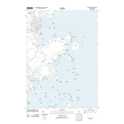
2011 Map of Rockland
USGS Topo · Published 2011About this map
Rockland and its busy working waterfront define this Knox County coastal survey, showing a landscape defined by maritime heritage and mid-coast industry. The harbor area is dense with nautical landmarks, from the Schooner Wharf and North End Shipyard to the long reach of the Rockland Breakwater, which terminates at the Rockland Breakwater Light. This area's cultural history is preserved at the William A Farnsworth Homestead and several local burial grounds, including Seaview Cemetery and Farnsworth Cemetery.
Find a feature on this map
141 named features on this map. Tap any name to fly to it.
Don’t see what you’re looking for? This feature index may not catch every label — zoom into the map to look around manually.
Map Details
Editions of this 2011 Rockland Map
This is the sole edition of this map. No revisions or reprints were ever made.
Other maps of this area

1904 · Vinalhaven
USGS Topo · 1:62,500

1904 · Tenants Harbor
USGS Topo · 1:62,500

1904 · Rockland
USGS Topo · 1:62,500

1905 · Penobscot Bay
USGS Topo · 1:125,000

1906 · Matinicus
USGS Topo · 1:62,500

1906 · Tennant Harbor
USGS Topo · 1:62,500

1906 · Rockland
USGS Topo · 1:62,500

1941 · Rockland
USGS Topo · 1:62,500

1941 · Vinalhaven
USGS Topo · 1:62,500

1944 · Vinalhaven
USGS Topo · 1:62,500