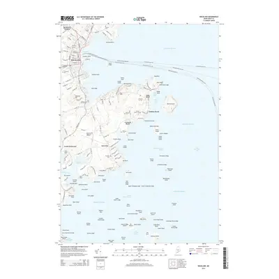
2014 Map of Rockland
USGS Topo · Published 2014About this map
The coastal harbor of Rockland and its surrounding peninsulas anchor this detailed survey of the Knox County shoreline. Multiple ferry routes, including the Rockland-Vinalhaven Fry and the Rockland-Matinicus Fry, radiate from the city piers into West Penobscot Bay, illustrating the area's continued reliance on maritime transit. To the south, the community of Owls Head is mapped in detail, showing a landscape densely dotted with local landmarks like Evergreen Cem and Holiday Beach.
Find a feature on this map
162 named features on this map. Tap any name to fly to it.
Don’t see what you’re looking for? This feature index may not catch every label — zoom into the map to look around manually.
Map Details
Editions of this 2014 Rockland Map
This is the sole edition of this map. No revisions or reprints were ever made.
Other maps of this area

1904 · Vinalhaven
USGS Topo · 1:62,500

1904 · Tenants Harbor
USGS Topo · 1:62,500

1904 · Rockland
USGS Topo · 1:62,500

1905 · Penobscot Bay
USGS Topo · 1:125,000

1906 · Matinicus
USGS Topo · 1:62,500

1906 · Tennant Harbor
USGS Topo · 1:62,500

1906 · Rockland
USGS Topo · 1:62,500

1941 · Rockland
USGS Topo · 1:62,500

1941 · Vinalhaven
USGS Topo · 1:62,500

1944 · Vinalhaven
USGS Topo · 1:62,500