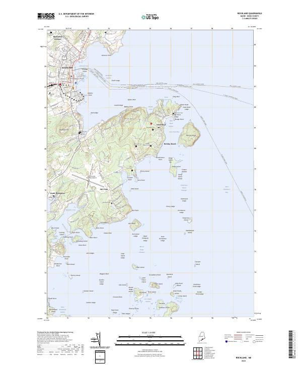
2024 Map of Rockland
USGS Topo · Published 2024About this map
Rockland serves as a central maritime hub on this modern survey, where the deep waters of Rockland Harbor meet a complex network of coastal roads and ferry routes. The maritime economy is evident in the numerous water-based transit lines, including the Neal Burgess Ferry, E. Frank Thompson Ferry, and Everett Libby Ferry threading through the islands and ledges. Inland, the landscape is dotted with small settlements like Blackinton Corners and Owls Head, alongside a significant concentration of local burial grounds such as Seaview Cem and Farnsworth Cem, providing valuable touchpoints for genealogical research.
Find a feature on this map
161 named features on this map. Tap any name to fly to it.
Don’t see what you’re looking for? This feature index may not catch every label — zoom into the map to look around manually.
Map Details
Editions of this 2024 Rockland Map
This is the sole edition of this map. No revisions or reprints were ever made.
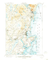
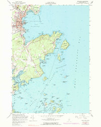
Historical Maps of Muscle Ridge Township Through Time
5 maps found