
1949 Map of Rockland
USGS Topo · Published 1965About this map
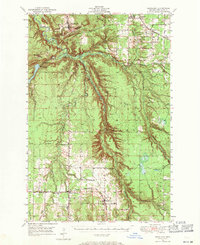
Rockland and the surrounding mining and timber country of Ontonagon County appear here just after the war, defined by a landscape of steep bluffs and river valleys. The Ontonagon River dominates the western topography, featuring the Victoria Dam Spillway and the settlement of Victoria. Local industry is evident through the presence of a shaft and gravel pit near the northern heights of South Bluff, while the southern portion of the map transitions into a grid of cleared land and small farming communities.
Find a feature on this map
49 named features on this map. Tap any name to fly to it.
Don’t see what you’re looking for? This feature index may not catch every label — zoom into the map to look around manually.
Map Details
Editions of this 1949 Rockland Map
2 editions found
Other maps of this area

1950 · Greenland
USGS Topo · 1:62,500

1951 · Rockland
USGS Topo · 1:62,500

1951 · Greenland
USGS Topo · 1:62,500

1952 · Watersmeet
USGS Topo · 1:62,500

1952 · Thayer
USGS Topo · 1:62,500

1954 · Rousseau
USGS Topo · 1:62,500

1954 · Kenton
USGS Topo · 1:62,500

1954 · Winona
USGS Topo · 1:62,500

1955 · Ontonagon
USGS Topo · 1:62,500

1956 · Matchwood
USGS Topo · 1:62,500