
1971 Map of Rockledge
USGS Topo · Published 1974About this map
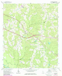
The Oconee River defines the southwestern corner of this landscape, where bottomlands like Muddy Slough and Cross Slough meet the river at Stave Landing. Much of the area is characterized by a network of drainage systems, including Hurricane Creek and Elias Branch, which feed into the wider basin. The map documents a period of significant infrastructure development in rural Laurens and Treutlen counties, clearly marking a major roadway as under construction across the center of the sheet. Small agricultural communities and gathering points are scattered throughout, anchored by local institutions such as Norris Chapel, Red Bluff Ch, and Blue Spring Ch. The Seaboard Coast Line railroad runs northwest to southeast, providing a transit spine that connects Rockledge, Orland, and the nearby Boy Scout Camp. Natural water features like Graham Ponds and Blue Spring highlight the hydrologic character of this Coastal Plain region.
Find a feature on this map
36 named features on this map. Tap any name to fly to it.
Don’t see what you’re looking for? This feature index may not catch every label — zoom into the map to look around manually.
Map Details
Editions of this 1971 Rockledge Map
2 editions found
Other maps of this area

1957 · Macon
USGS Topo · 1:250,000

1958 · Macon
USGS Topo · 1:250,000

1964 · Macon
USGS Topo · 1:250,000

1971 · Soperton South
USGS Topo · 1:24,000

1971 · Soperton North
USGS Topo · 1:24,000

1971 · Lothair
USGS Topo · 1:24,000

1974 · Lowery
USGS Topo · 1:24,000

1974 · East Dublin
USGS Topo · 1:24,000

1974 · Scott
USGS Topo · 1:24,000
1974 · Adrian
USGS Topo · 1:24,000