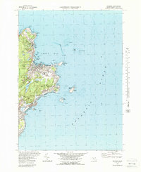
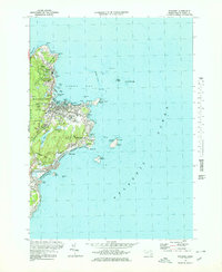
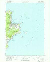
1973 Map of Rockport
USGS Topo · Published 1989About this map
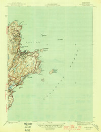
Pigeon Cove and the working harbor of Rockport define this coastal landscape, where the granite industry's legacy is visible in numerous quarries and reservoirs like Quarry Res. The 1970s shoreline is meticulously detailed, from the rocky outcrops of Halibut Pt to the sandy stretches of Long Beach. Navigational landmarks such as the Cape Ann Lighthouse on Thacher Island and the lighthouse on Straitsmouth Island overlook Sandy Bay, marking the entrance to one of the region's most famous maritime corridors.
Find a feature on this map
77 named features on this map. Tap any name to fly to it.
Don’t see what you’re looking for? This feature index may not catch every label — zoom into the map to look around manually.
Map Details
Editions of this 1973 Rockport Map
3 editions found
Other maps of this area

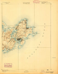
1886 · Gloucester
USGS Topo · 1:62,500

1888 · Gloucester
USGS Topo · 1:62,500
1893 · Gloucester
USGS Topo · 1:62,500

1918 · Gloucester
USGS Topo · 1:62,500

1943 · Cape Ann
USGS Topo · 1:125,000
1945 · Rockport
USGS Topo · 1:31,680

1947 · Rockport
USGS Topo · 1:25,000

1948 · Boston
USGS Topo · 1:250,000

1949 · Rockport
USGS Topo · 1:24,000

1956 · Boston
USGS Topo · 1:250,000