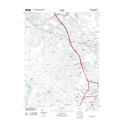
2011 Map of Rockville
USGS Topo · Published 2011About this map
Great Falls and the rocky islands of the Potomac River anchor the southwestern corner of this Montgomery County landscape, where the transition from riverine wilderness to dense suburban development is clearly mapped. The terrain rises from the riverbanks toward established communities like Potomac and Hunting Hill, reflecting the intensive growth of the late 20th century. This 2011 survey documents a complex network of residential subdivisions, such as Potomac Manors and Washingtonian Woods, interspersed with established institutional landmarks like the Shady Grove Medical Village and the United States Postal Training Facility.
Find a feature on this map
129 named features on this map. Tap any name to fly to it.
Don’t see what you’re looking for? This feature index may not catch every label — zoom into the map to look around manually.
Map Details
Editions of this 2011 Rockville Map
This is the sole edition of this map. No revisions or reprints were ever made.
Other maps of this area

1890 · Mt. Vernon
USGS Topo · 1:125,000

1891 · Mt. Vernon
USGS Topo · 1:125,000

1893 · Frederick
USGS Topo · 1:125,000

1894 · Frederick
USGS Topo · 1:125,000

1894 · Mt. Vernon
USGS Topo · 1:125,000

1897 · Mt. Vernon
USGS Topo · 1:125,000

1900 · Washington
USGS Topo · 1:62,500

1908 · Rockville
USGS Topo · 1:62,500

1908 · Seneca
USGS Topo · 1:62,500

1915 · Fairfax
USGS Topo · 1:62,500