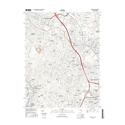
2016 Map of Rockville
USGS Topo · Published 2016About this map
The Potomac River corridor defines the southwestern edge of this Montgomery County landscape, where the Chesapeake & Ohio Canal follows the river's bend near Great Falls Lake. This era shows the dense suburban maturation of the region, anchored by the municipal centers of Gaithersburg, Rockville, and Bethesda. The transition from riverine parklands like the Chesapeake and Ohio Canal National Historical Park to intensive residential developments is marked by a complex network of named neighborhoods, including Hungerford Towne, Tilden Woods, and Bradley Hills Grove. Education and local heritage are well-preserved through landmarks such as the Montgomery Coll Rockville Campus and several historical burial sites, including Saint Marys Cem and the Union Armory Cem. The terrain is deeply etched by a series of tributaries such as Watts Br and Cabin John Cr that flow toward the Potomac.
Find a feature on this map
116 named features on this map. Tap any name to fly to it.
Don’t see what you’re looking for? This feature index may not catch every label — zoom into the map to look around manually.
Map Details
Editions of this 2016 Rockville Map
This is the sole edition of this map. No revisions or reprints were ever made.
Other maps of this area

1890 · Mt. Vernon
USGS Topo · 1:125,000

1891 · Mt. Vernon
USGS Topo · 1:125,000

1893 · Frederick
USGS Topo · 1:125,000

1894 · Frederick
USGS Topo · 1:125,000

1894 · Mt. Vernon
USGS Topo · 1:125,000

1897 · Mt. Vernon
USGS Topo · 1:125,000

1900 · Washington
USGS Topo · 1:62,500

1908 · Rockville
USGS Topo · 1:62,500

1908 · Seneca
USGS Topo · 1:62,500

1915 · Fairfax
USGS Topo · 1:62,500