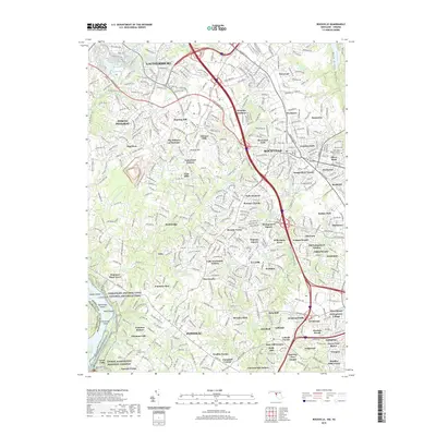
2019 Map of Rockville
USGS Topo · Published 2019About this map
Rockville and Gaithersburg dominate this landscape, reflecting the intensive suburban development of Montgomery County in the early 21st century. The map reveals an intricate network of residential subdivisions such as Hungerford Towne, Potomac Woods, and Glenora Hills, interwoven with established transit corridors like the Metro rail line. Despite this expansion, significant green spaces and historical markers remain, notably the Chesapeake and Ohio Canal National Historical Park along the southern border. Genealogists may find value in the detailed locations of burial sites like the New Saint Mary's Catholic Church Cem and Saint Gabriel Cem. The terrain is defined by the drainages of Watts Branch and Rock Creek, which provide natural breaks in the dense grid of streets and parkways.
Find a feature on this map
448 named features on this map. Tap any name to fly to it.
Don’t see what you’re looking for? This feature index may not catch every label — zoom into the map to look around manually.
Map Details
Editions of this 2019 Rockville Map
This is the sole edition of this map. No revisions or reprints were ever made.
Other maps of this area

1890 · Mt. Vernon
USGS Topo · 1:125,000

1891 · Mt. Vernon
USGS Topo · 1:125,000

1893 · Frederick
USGS Topo · 1:125,000

1894 · Frederick
USGS Topo · 1:125,000

1894 · Mt. Vernon
USGS Topo · 1:125,000

1897 · Mt. Vernon
USGS Topo · 1:125,000

1900 · Washington
USGS Topo · 1:62,500

1908 · Rockville
USGS Topo · 1:62,500

1908 · Seneca
USGS Topo · 1:62,500

1915 · Fairfax
USGS Topo · 1:62,500