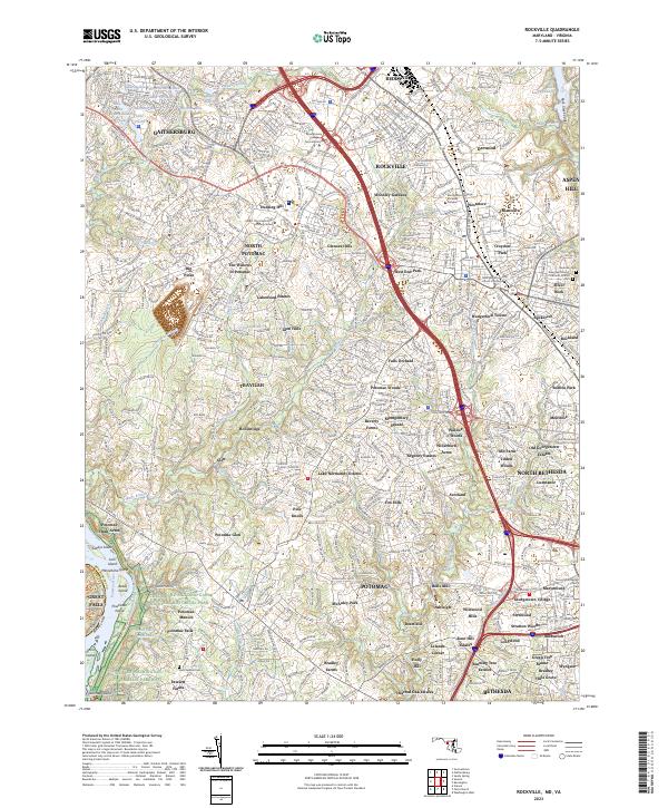
2023 Map of Rockville
USGS Topo · Published 2023About this map
The Potomac River corridor and its storied Chesapeake and Ohio Canal define the southwestern edge of this modern landscape. This map documents a densely developed Maryland corridor where historic landmarks like the Montgomery County Circuit Courthouse stand alongside large institutional campuses such as Montgomery College - Rockville Campus. The transition from the urban centers of Rockville and Gaithersburg to the suburban enclaves of North Potomac and Travilah is mediated by significant parklands and water bodies, including Lake Needwood and the northern reaches of Rock Creek. Local history is anchored by sites like the Saint Gabriel Cem and the New Saint Mary's Catholic Church, providing vital points of reference for genealogists. The dramatic geography of Great Falls remains a focal point where the Virginia and Maryland border is shaped by the river's rocky islands, including Powhatan Island and Conn Island.
Find a feature on this map
108 named features on this map. Tap any name to fly to it.
Don’t see what you’re looking for? This feature index may not catch every label — zoom into the map to look around manually.
Map Details
Editions of this 2023 Rockville Map
This is the sole edition of this map. No revisions or reprints were ever made.
Other maps of this area

1890 · Mt. Vernon
USGS Topo · 1:125,000

1891 · Mt. Vernon
USGS Topo · 1:125,000

1893 · Frederick
USGS Topo · 1:125,000

1894 · Frederick
USGS Topo · 1:125,000

1894 · Mt. Vernon
USGS Topo · 1:125,000

1897 · Mt. Vernon
USGS Topo · 1:125,000

1900 · Washington
USGS Topo · 1:62,500

1908 · Rockville
USGS Topo · 1:62,500

1908 · Seneca
USGS Topo · 1:62,500

1915 · Fairfax
USGS Topo · 1:62,500