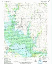
1991 Map of Rockville
USGS Topo · Published 1991About this map
The Osage River meanders through the heart of this landscape, forming the boundary between Bates, Vernon, and St. Clair counties. The river valley is dominated by the expansive Schell-Osage Wildlife Area, a complex network of wetlands and managed waters including Schell Lake, Atkinson Lake, and numerous oxbow features like Horseshoe Lake and Maus Lake. This topography reveals a heavy reliance on flood control and conservation, with levees protecting low-lying tracts near Granddad Slough and various ponds like Old Folks Pond dotting the bottomlands.
Find a feature on this map
43 named features on this map. Tap any name to fly to it.
Don’t see what you’re looking for? This feature index may not catch every label — zoom into the map to look around manually.
Map Details
Editions of this 1991 Rockville Map
This is the sole edition of this map. No revisions or reprints were ever made.
Other maps of this area

1886 · Nevada
USGS Topo · 1:125,000

1886 · Stockton
USGS Topo · 1:125,000

1887 · Clinton
USGS Topo · 1:125,000

1887 · Butler
USGS Topo · 1:125,000

1894 · Butler
USGS Topo · 1:125,000

1894 · Nevada
USGS Topo · 1:125,000

1894 · Clinton
USGS Topo · 1:125,000

1934 · Papinsville
USGS Topo · 1:24,000

1934 · Rockville
USGS Topo · 1:24,000

1937 · Tiffin
USGS Topo · 1:31,680