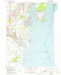
1967 Map of Rockwood
USGS Topo · Published 1974About this map
The Detroit River and Lake Erie shoreline define this late 1960s landscape, where industrial activity and conservation efforts sit side-by-side along the United States Canada border. The Grosse Ile Naval Air Station occupies the southern tip of Grosse Ile, marking a significant military footprint amidst the various channels and islands of the archipelago. On the mainland, the heavy presence of the Penn Central and Detroit Toledo and Ironton railroads underscores the region's importance as a transportation corridor between major Great Lakes hubs.
Find a feature on this map
88 named features on this map. Tap any name to fly to it.
Don’t see what you’re looking for? This feature index may not catch every label — zoom into the map to look around manually.
Map Details
Editions of this 1967 Rockwood Map
3 editions found
Other maps of this area

1906 · Wyandotte
USGS Topo · 1:62,500

1906 · Romulus
USGS Topo · 1:62,500

1912 · Wyandotte
USGS Topo · 1:62,500

1912 · Monroe
USGS Topo · 1:62,500

1914 · Monroe
USGS Topo · 1:62,500

1928 · Romulus
USGS Topo · 1:62,500

1929 · Wyandotte
USGS Topo · 1:62,500

1936 · Wyandotte
USGS Topo · 1:31,680

1936 · Rockwood
USGS Topo · 1:31,680

1936 · Stony Point
USGS Topo · 1:31,680