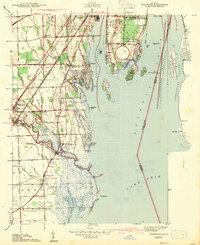
1942 Map of Rockwood
USGS Topo · Published 1942About this map
Grosse Ile dominates the upper reach of the Detroit River on this 1940s survey, showing the intricate network of channels and islands that define the Michigan-Ontario border. The landscape transitions from the industrial corridor of Trenton and Gibraltar to the coastal wetlands of Point Mouille. Navigational features like the Livingstone Channel and Amherstburg Channel slice through the river, essential for the Great Lakes shipping economy.
Find a feature on this map
79 named features on this map. Tap any name to fly to it.
Don’t see what you’re looking for? This feature index may not catch every label — zoom into the map to look around manually.
Map Details
Editions of this 1942 Rockwood Map
2 editions found
Other maps of this area

1906 · Wyandotte
USGS Topo · 1:62,500

1906 · Romulus
USGS Topo · 1:62,500

1912 · Wyandotte
USGS Topo · 1:62,500

1912 · Monroe
USGS Topo · 1:62,500

1914 · Monroe
USGS Topo · 1:62,500

1928 · Romulus
USGS Topo · 1:62,500

1929 · Wyandotte
USGS Topo · 1:62,500

1936 · Wyandotte
USGS Topo · 1:31,680

1936 · Rockwood
USGS Topo · 1:31,680

1936 · Stony Point
USGS Topo · 1:31,680