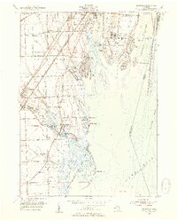
1952 Map of Rockwood
USGS Topo · Published 1954About this map
The Grosse Ile Naval Air Station anchors the eastern side of this coastal survey, where the Detroit River meets Lake Erie. This landscape is defined by its complex waterways and islands, including Grosse Ile Country Club and the myriad smaller landforms like Meso Island and Hickory Island that separate Gibraltar Bay from the international boundary. Along the shore, the Mouillee State Game Area protects the wetlands around Pointe Mouillee, while inland, the economy transitions to the rail-oriented industrial corridors of Rockwood and Trenton. The presence of the Silica Pit near South Rockwood and the heavy rail lines of the Detroit and Toledo Shore Line indicate the region's 1950s role as a vital industrial artery between Detroit and Toledo. Local life is centered around institutions like Vreeland Tabernacle and St Marys Ch.
Find a feature on this map
68 named features on this map. Tap any name to fly to it.
Don’t see what you’re looking for? This feature index may not catch every label — zoom into the map to look around manually.
Map Details
Editions of this 1952 Rockwood Map
2 editions found
Other maps of this area

1906 · Wyandotte
USGS Topo · 1:62,500

1906 · Romulus
USGS Topo · 1:62,500

1912 · Wyandotte
USGS Topo · 1:62,500

1912 · Monroe
USGS Topo · 1:62,500

1914 · Monroe
USGS Topo · 1:62,500

1928 · Romulus
USGS Topo · 1:62,500

1929 · Wyandotte
USGS Topo · 1:62,500

1936 · Wyandotte
USGS Topo · 1:31,680

1936 · Rockwood
USGS Topo · 1:31,680

1936 · Stony Point
USGS Topo · 1:31,680