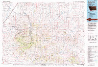
1993 Map of Rocky Boy
USGS Topo · Published 1994About this map
The Bears Paw Mountains dominate this 1993 study of north-central Montana, where the peaks of Baldy Mtn and Moses Mountain rise sharply above the high plains. Much of the western terrain is defined by the Rocky Boys Indian Reservation, featuring a complex network of coulees and ridges such as Manikanis Ridge and Keifer Ridge. Historical importance is marked at the Nez Perce National Historical Park Bears Paw Battlefield in the northeast, the site of the 1877 surrender of Chief Joseph.
Find a feature on this map
112 named features on this map. Tap any name to fly to it.
Don’t see what you’re looking for? This feature index may not catch every label — zoom into the map to look around manually.
Map Details
Editions of this 1993 Rocky Boy Map
This is the sole edition of this map. No revisions or reprints were ever made.
Other maps of this area

1890 · Fort Benton
USGS Topo · 1:250,000

1892 · Fort Benton
USGS Topo · 1:250,000

1897 · Fort Benton
USGS Topo · 1:250,000

1904 · Yantic
USGS Topo · 1:62,500

1904 · Chinook
USGS Topo · 1:62,500

1904 · Havre
USGS Topo · 1:62,500

1904 · Assinniboine
USGS Topo · 1:62,500

1904 · Boxelder
USGS Topo · 1:62,500

1905 · Harlem
USGS Topo · 1:62,500

1906 · Kremlin
USGS Topo · 1:62,500