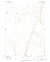
1971 Map of Rocky Canyon
USGS Topo · Published 1975About this map
Guano Valley and its dramatic eastern boundary, the Guano Rim, dominate this 1971 topographical study of Lake County. This arid landscape is defined by its verticality, where the steep escarpment of the rim drops sharply toward the valley floor, revealing the striking feature known as Wagonslide. Human presence in this high desert environment is sparse, centered on the Spalding Ranch and the rudimentary path of Beatys Butte Road, which navigates the terrain between deep incisions like Sage Hen Canyon and Rocky Canyon.
Find a feature on this map
14 named features on this map. Tap any name to fly to it.
Don’t see what you’re looking for? This feature index may not catch every label — zoom into the map to look around manually.
Map Details
Editions of this 1971 Rocky Canyon Map
This is the sole edition of this map. No revisions or reprints were ever made.
Other maps of this area

1955 · Adel
USGS Topo · 1:250,000

1957 · Adel
USGS Topo · 1:250,000

1958 · Adel
USGS Topo · 1:250,000

1962 · Adel
USGS Topo · 1:250,000

1967 · Alger Lake
USGS Topo · 1:24,000
1968 · Piute Reservoir
USGS Topo · 1:24,000

1968 · Guano Lake
USGS Topo · 1:24,000

1971 · Mahogany Butte
USGS Topo · 1:24,000
1971 · Sage Hen Flats
USGS Topo · 1:24,000
1971 · Chimney Rock
USGS Topo · 1:24,000