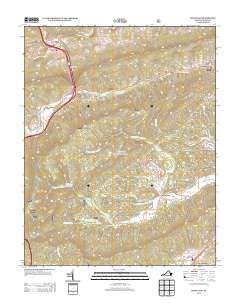
2013 Map of Rocky Gap
USGS Topo · Published 2013About this map
Rocky Gap serves as the primary junction in this mountain corridor, where the waters of Wolf Cr and Clear Fork converge. The settlement pattern follows the narrow valley floors, extending from the namesake gap down toward South Gap. To the east, smaller hamlets like Pumpkin Center and Kimberling sit tucked along the drainage of Wilderness Cr and N Fork Kimberling Cr, illustrating the dispersed rural community structure of Bland County. The map details a landscape defined by significant watercourse networks, including the headwaters of Helveys Mill Cr and the Middle Fork Kimberling Cr. These streams were central to the early industrial and agricultural development of the region, providing the necessary power and access for remote settlements such as Point Pleasant located near the southern edge of the quadrangle.
Find a feature on this map
21 named features on this map. Tap any name to fly to it.
Don’t see what you’re looking for? This feature index may not catch every label — zoom into the map to look around manually.
Map Details
Editions of this 2013 Rocky Gap Map
This is the sole edition of this map. No revisions or reprints were ever made.
Other maps of this area

1887 · Pocahontas
USGS Topo · 1:125,000

1890 · Dublin
USGS Topo · 1:125,000

1891 · Pocahontas
USGS Topo · 1:125,000

1891 · Dublin
USGS Topo · 1:125,000

1894 · Pocahontas
USGS Topo · 1:125,000

1895 · Pocahontas
USGS Topo · 1:125,000

1913 · Peterstown
USGS Topo · 1:48,000

1913 · Bluefield
USGS Topo · 1:48,000

1916 · Bluefield
USGS Topo · 1:62,500

1916 · Peterstown
USGS Topo · 1:62,500