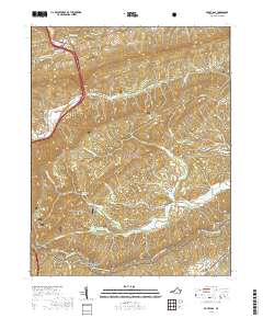
2019 Map of Rocky Gap
USGS Topo · Published 2019About this map
Rocky Gap serves as a critical mountain pass where Wolf Creek and Laurel Cr converge, shaping the valley floor around modern transit corridors. This 2019 survey documents the enduring settlement patterns of Bland County, from the namesake gap to the rural clusters of Kimberling and Point Pleasant. The terrain is dominated by the ridges of the Jefferson National Forest, where the Appalachian National Scenic Trail winds through the southern reaches of the map. Genealogists will find several burial sites noted, including Toggle Cem and Hoges Chapel Cem, alongside landmarks of the area's agricultural and industrial past such as Helveys Mill and the Helvey Mill Shelter. The complex drainage network of N Fork Kimberling Cr and Sulphur Spring Fork illustrates the steep topography that has long channeled travel and habitation along specific valley roads like State Rte 612.
Find a feature on this map
33 named features on this map. Tap any name to fly to it.
Don’t see what you’re looking for? This feature index may not catch every label — zoom into the map to look around manually.
Map Details
Editions of this 2019 Rocky Gap Map
This is the sole edition of this map. No revisions or reprints were ever made.
Other maps of this area

1887 · Pocahontas
USGS Topo · 1:125,000

1890 · Dublin
USGS Topo · 1:125,000

1891 · Pocahontas
USGS Topo · 1:125,000

1891 · Dublin
USGS Topo · 1:125,000

1894 · Pocahontas
USGS Topo · 1:125,000

1895 · Pocahontas
USGS Topo · 1:125,000

1913 · Peterstown
USGS Topo · 1:48,000

1913 · Bluefield
USGS Topo · 1:48,000

1916 · Bluefield
USGS Topo · 1:62,500

1916 · Peterstown
USGS Topo · 1:62,500