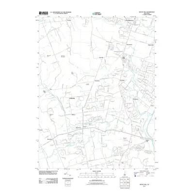
2011 Map of Rocky Hill
USGS Topo · Published 2011About this map
Rocky Hill and its surrounding countryside are defined by the winding course of the Millstone River and the engineered path of the Delaware and Raritan Canal. This area of Somerset County maintains a character of established villages and institutional land use, with notable landmarks like the Princeton Airport and the Belle Mead Quarry puncturing the landscape. The western edge is dominated by the rise of Sourland Mountain, while a network of smaller streams including Pike Run, Beden Brook, and Roaring Brook carve the terrain between the settlements of Skillman, Blawenburg, and Harlingen. Local history is anchored by several burial grounds, including the Harlingen Reformed Cemetery and Stoutsburg Cemetery. The presence of the Skillman Dam on Sylvan Lake and various named mills like Rock Mill suggests a landscape shaped by historical water management and early industry, even as modern residential clusters begin to expand near Bloomingdale and Belle Mead.
Find a feature on this map
206 named features on this map. Tap any name to fly to it.
Don’t see what you’re looking for? This feature index may not catch every label — zoom into the map to look around manually.
Map Details
Editions of this 2011 Rocky Hill Map
This is the sole edition of this map. No revisions or reprints were ever made.
Other maps of this area

1888 · Princeton
USGS Topo · 1:62,500

1890 · High Bridge
USGS Topo · 1:62,500

1890 · Lambertville
USGS Topo · 1:62,500

1891 · Somerville
USGS Topo · 1:62,500

1891 · Lambertville
USGS Topo · 1:62,500

1893 · Somerville
USGS Topo · 1:62,500

1894 · Princeton
USGS Topo · 1:62,500

1894 · Lambertville
USGS Topo · 1:62,500

1898 · High Bridge
USGS Topo · 1:62,500

1898 · Somerville
USGS Topo · 1:62,500
Featured Places
- Franklin Township, NJ
- Hillsborough Township, NJ
- Montgomery Township, NJ
- Hopewell Township, NJ
- Princeton, NJ