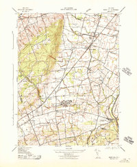
1943 Map of Rocky Hill
USGS Topo · Published 1943About this map
Sourland Mountain Hills dominate the western edge of this Somerset County landscape, giving way to a network of agrarian settlements and early wartime infrastructure during the early 1940s. The central corridor is defined by the Reading railroad, which links historic villages like Skillman, Belle Meade, and Harlingen. A notable concentration of institutional and military activity is present, including the extensive grounds of the State Village for Epileptics and the War Aid Depot near Hillsboro.
Find a feature on this map
45 named features on this map. Tap any name to fly to it.
Don’t see what you’re looking for? This feature index may not catch every label — zoom into the map to look around manually.
Map Details
Editions of this 1943 Rocky Hill Map
This is the sole edition of this map. No revisions or reprints were ever made.
Other maps of this area

1888 · Princeton
USGS Topo · 1:62,500

1890 · High Bridge
USGS Topo · 1:62,500

1890 · Lambertville
USGS Topo · 1:62,500

1891 · Somerville
USGS Topo · 1:62,500

1891 · Lambertville
USGS Topo · 1:62,500

1893 · Somerville
USGS Topo · 1:62,500

1894 · Princeton
USGS Topo · 1:62,500

1894 · Lambertville
USGS Topo · 1:62,500

1898 · High Bridge
USGS Topo · 1:62,500

1898 · Somerville
USGS Topo · 1:62,500
Featured Places
- Franklin Township, NJ
- Hillsborough Township, NJ
- Montgomery Township, NJ
- Hopewell Township, NJ
- Princeton, NJ