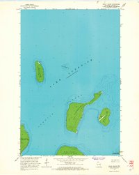
1963 Map of Rocky Island
USGS Topo · Published 1965About this map
Lake Superior surrounds the northernmost reaches of the Apostle Islands in this mid-century topographic record of La Pointe Twp. The map documents a landscape defined by navigation and light aviation rather than roads, showcasing the isolated infrastructure of the outer archipelago. On Devils Island, a prominent Light and Radio Tower serve as critical maritime markers, while the elongated Rocky Island and neighboring South Twin Island feature a small Landing Strip, indicating the reliance on air transport for these remote outposts. Underwater hazards are meticulously noted, including the Devils Island Shoal, which sits between the main islands and the open lake. This survey captures the islands before their transition into a national lakeshore, preserving the layout of private and municipal developments on Bear Island, Otter Island, and Ironwood Island.
Find a feature on this map
13 named features on this map. Tap any name to fly to it.
Don’t see what you’re looking for? This feature index may not catch every label — zoom into the map to look around manually.
Map Details
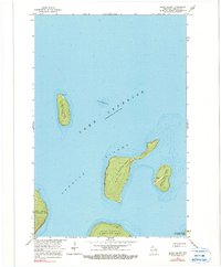
Editions of this 1963 Rocky Island Map
2 editions found
Other maps of this area

1941 · Bayfield
USGS Topo · 1:48,000

1946 · Bayfield
USGS Topo · 1:48,000

1953 · Ashland
USGS Topo · 1:250,000

1954 · Two Harbors
USGS Topo · 1:250,000

1957 · Two Harbors
USGS Topo · 1:250,000

1958 · Ashland
USGS Topo · 1:250,000

1958 · Two Harbors
USGS Topo · 1:250,000

1963 · Cat Island
USGS Topo · 1:24,000

1963 · Rocky Island
USGS Topo · 1:62,500

1963 · Oak Island
USGS Topo · 1:24,000