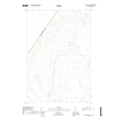
2018 Map of Rocky Mountain NW
USGS Topo · Published 2018About this map
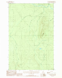
The United States and Canada border defines the northwestern edge of this landscape, where the international boundary line cuts diagonally across the timbered highlands of northernmost Maine. A network of private forest roads, including Irving Rd and Canada Rd, provides the primary access to this remote working forest. The topography is dominated by the drainages of the Pocwock Stream system, including the W Br Pocwock Stream and E Br Pocwock Stream, which flow through deep valleys and expansive wetlands. To the north, the Campbell Br Little Black River meanders toward the border, illustrating the complex hydrography of the St. John River watershed. This survey provides a clear view of the industrial and geographic character of the North Maine Woods, where the landscape is shaped by modern logging routes like Roaichadd Ln and the natural flow of the Chimenticook Stream.
Find a feature on this map
11 named features on this map. Tap any name to fly to it.
Don’t see what you’re looking for? This feature index may not catch every label — zoom into the map to look around manually.
Map Details
Editions of this 2018 Rocky Mountain NW Map
This is the sole edition of this map. No revisions or reprints were ever made.
Other maps of this area

1955 · Rocky Mountain
USGS Topo · 1:62,500

1955 · Little East Lake
USGS Topo · 1:62,500

1955 · Rocky Brook
USGS Topo · 1:62,500

1962 · Edmundston
USGS Topo · 1:250,000

1976 · East Lake
USGS Topo · 1:24,000

1976 · East Lake SE
USGS Topo · 1:24,000
1987 · Rocky Mountain SW
USGS Topo · 1:24,000
1987 · Schoolhouse Rapids
USGS Topo · 1:24,000
1987 · Morrison Brook
USGS Topo · 1:24,000
1987 · Rocky Mountain
USGS Topo · 1:24,000