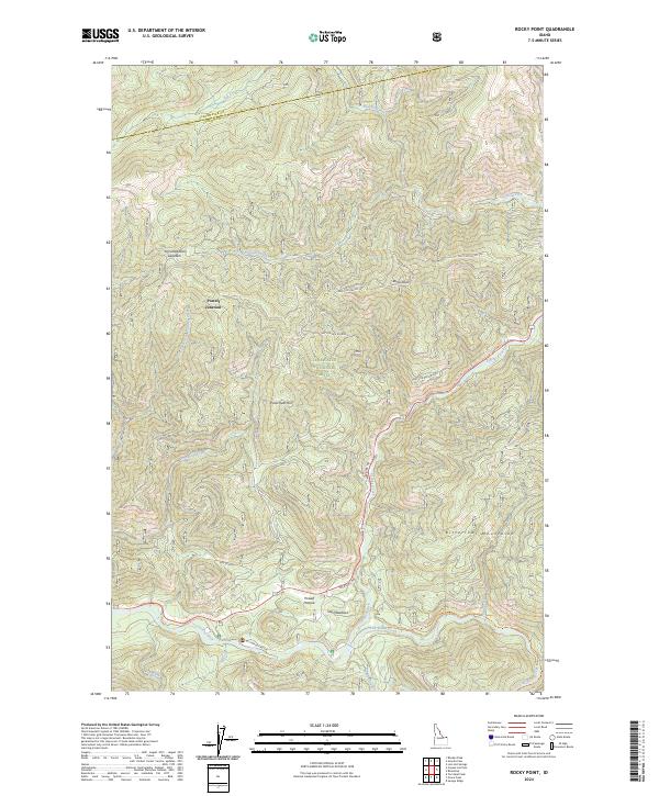
2024 Map of Rocky Point
USGS Topo · Published 2024About this map
Clearwater National Forest dominates this landscape within the Bitterroot Mountains, where the modern administrative footprint of the Clearwater Fish Hatchery sits alongside historic mountain transit routes. The legendary Lolo Motor Way winds along the northern ridges, tracing high ground above deep drainages like Shotgun Creek and the Crooked Fork. These steep valleys converge toward the Middle Fork Clearwater Wild and Scenic River near the southern boundary. Settlement and activity are concentrated in specific mountain clearings and junctions, notably at Powell Junction and Powell Pasture. This 2024 map documents a wilderness character defined by water and elevation, from the heights of Parachute Hill and the former observation point at Rocky Pt Lookout down to the confluence of Walton Creek and Colt Killed Creek.
Find a feature on this map
38 named features on this map. Tap any name to fly to it.
Don’t see what you’re looking for? This feature index may not catch every label — zoom into the map to look around manually.
Map Details
Editions of this 2024 Rocky Point Map
This is the sole edition of this map. No revisions or reprints were ever made.
Other maps of this area

1911 · Lolo
USGS Topo · 1:250,000

1913 · Lolo
USGS Topo · 1:250,000

1956 · Hamilton
USGS Topo · 1:250,000

1959 · Hamilton
USGS Topo · 1:250,000

1960 · Hamilton
USGS Topo · 1:250,000

1964 · Hamilton
USGS Topo · 1:250,000

1964 · Lolo Hot Springs
USGS Topo · 1:24,000

1964 · Rocky Point
USGS Topo · 1:24,000

1964 · Roundtop
USGS Topo · 1:24,000
1964 · Granite Pass
USGS Topo · 1:24,000