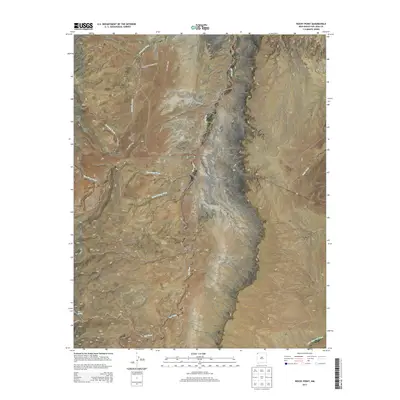
2013 Map of Rocky Point
USGS Topo · Published 2013About this map
The settlement of Beclabito serves as the focal point of this high-desert landscape in the Shiprock Agency region. The terrain is defined by a series of dramatic geographic features, from the heights of Rock Pile Mesa and Bruised Ridge down to the deep incisions of Cottonwood Canyon and Last Canyon. Hydrology in this arid environment is represented by a network of seasonal drainages, most notably Red Wash and the winding Beclabito Wash, which cut through the sandy expanses of White Flat. Evidence of regional infrastructure is visible through the routes of BIA Road 5038 and BIA Route 5113, which connect the scattered homesteads and traditional grazing lands. Natural landmarks like Rocky Point and Black Rock Point provide distinct navigational markers across the varied topography of northwestern New Mexico.
Find a feature on this map
24 named features on this map. Tap any name to fly to it.
Don’t see what you’re looking for? This feature index may not catch every label — zoom into the map to look around manually.
Map Details
Editions of this 2013 Rocky Point Map
This is the sole edition of this map. No revisions or reprints were ever made.
Other maps of this area

1889 · Chaco
USGS Topo · 1:250,000

1892 · Chaco
USGS Topo · 1:250,000

1892 · Canyon De Chelly
USGS Topo · 1:250,000

1934 · Ship Rock
USGS Topo · 1:62,500

1934 · Rattlesnake
USGS Topo · 1:62,500

1937 · Ship Rock
USGS Topo · 1:62,500

1937 · Rattlesnake
USGS Topo · 1:62,500

1953 · Redrock Valley NE
USGS Topo · 1:24,000

1953 · Pastora Peak NE
USGS Topo · 1:24,000

1953 · Pastora Peak SE
USGS Topo · 1:24,000