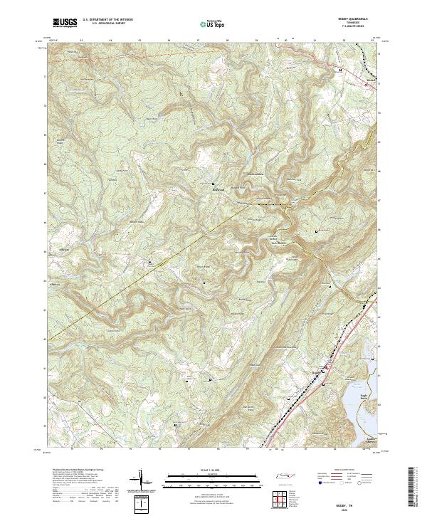
2022 Map of Roddy
USGS Topo · Published 2022About this map
The Cumberland Escarpment dominates the eastern edge of this landscape, where the plateau drops toward the Back Valley and the waters of Watts Bar Lake. This 2022 survey documents a rugged corridor defined by narrow ridges and family cemeteries such as Kelley Cem, Mount Zion Cem, and Garrison Cem. The settlement pattern follows the relief, with Roddy situated along the Dixie Lee Hwy and the local rail line, while higher elevations host smaller communities like Westel and Dogwood. The terrain is deeply incised by drainages like Fall Creek and Piney Creek, which carve out features with distinctive local names including Negro Jumpoff, Wildcat Hollow, and the Frying Pan. Near the lake, the development of Apollo Shores and the 100 Aker Wood Airport indicate more modern land use contrasting with the traditional hollows and ridges that have long shaped life in this corner of Tennessee.
Find a feature on this map
150 named features on this map. Tap any name to fly to it.
Don’t see what you’re looking for? This feature index may not catch every label — zoom into the map to look around manually.
Map Details
Editions of this 2022 Roddy Map
This is the sole edition of this map. No revisions or reprints were ever made.
Other maps of this area

1887 · Kingston
USGS Topo · 1:125,000

1891 · Kingston
USGS Topo · 1:125,000

1893 · Kingston
USGS Topo · 1:125,000

1935 · Rockwood
USGS Topo · 1:24,000

1935 · Pennine
USGS Topo · 1:24,000

1936 · Roddy
USGS Topo · 1:24,000
1936 · Ozone
USGS Topo · 1:24,000

1936 · Cardiff
USGS Topo · 1:24,000

1936 · Spring City
USGS Topo · 1:24,000
1936 · Grassy Cove
USGS Topo · 1:24,000