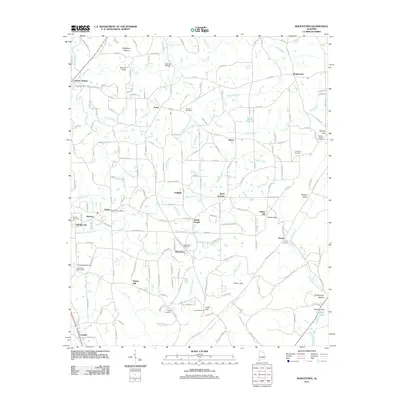
2011 Map of Rodentown
USGS Topo · Published 2011About this map
Rodentown and the surrounding Etowah and Marshall County borderlands are defined by a complex network of gaps and hollows at the start of the 21st century. The landscape is marked by the varied watercourses of Coal Creek, Short Creek, and Reedy Creek, which wind between topographic features like Horton Gap and Dugout Valley. This era shows a community rooted in local institutions, evidenced by the Fenton Post Office and the Smith Institute, alongside a high density of family and community burial grounds including Whitesboro and Leath Cemetery. Small, established settlements such as Sardis City, Carlisle, and Arona anchor the rural road network, while engineering features like Stephens Dam on Stephens Lake suggest the managed water resources of the region. The transition between the high ground of Liberty Hill and the low-lying Penitentiary Hollow illustrates the varied terrain that has historically shaped settlement patterns in this part of Alabama.
Find a feature on this map
188 named features on this map. Tap any name to fly to it.
Don’t see what you’re looking for? This feature index may not catch every label — zoom into the map to look around manually.
Map Details
Editions of this 2011 Rodentown Map
This is the sole edition of this map. No revisions or reprints were ever made.
Other maps of this area

1885 · Gadsden
USGS Topo · 1:125,000

1888 · Gadsden
USGS Topo · 1:125,000

1892 · Gadsden
USGS Topo · 1:125,000

1893 · Fort Payne
USGS Topo · 1:125,000

1895 · Gadsden
USGS Topo · 1:125,000

1898 · Fort Payne
USGS Topo · 1:125,000

1900 · Fort Payne
USGS Topo · 1:125,000

1903 · Gadsden
USGS Topo · 1:125,000

1936 · Painter
USGS Topo · 1:24,000

1936 · Crossville
USGS Topo · 1:24,000