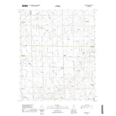
2018 Map of Rodentown
USGS Topo · Published 2018About this map
Sardis City and Mountainboro anchor the lower reaches of this Alabama landscape, where the Tennessee Valley Divide marks a significant geographic break in the terrain. The map documents a complex network of county roads, such as Leeth Gap Rd and Co Rd 388, connecting numerous family-named landmarks and rural centers. The drainage pattern is defined by several watercourses including Short Creek, Cross Cr, and Big Wills Creek in the south, which runs parallel to Big Ridge. Numerous community sites like the Smith Institute, Whitesboro, and Arana illustrate the persistent settlement patterns of this region. Local history is well-preserved through several burial grounds, including Union Cem near Double Bridges and Corinth Cem, providing valuable touchpoints for genealogical research in this part of Marshall, DeKalb, and Etowah Counties.
Find a feature on this map
173 named features on this map. Tap any name to fly to it.
Don’t see what you’re looking for? This feature index may not catch every label — zoom into the map to look around manually.
Map Details
Editions of this 2018 Rodentown Map
This is the sole edition of this map. No revisions or reprints were ever made.
Other maps of this area

1885 · Gadsden
USGS Topo · 1:125,000

1888 · Gadsden
USGS Topo · 1:125,000

1892 · Gadsden
USGS Topo · 1:125,000

1893 · Fort Payne
USGS Topo · 1:125,000

1895 · Gadsden
USGS Topo · 1:125,000

1898 · Fort Payne
USGS Topo · 1:125,000

1900 · Fort Payne
USGS Topo · 1:125,000

1903 · Gadsden
USGS Topo · 1:125,000

1936 · Painter
USGS Topo · 1:24,000

1936 · Crossville
USGS Topo · 1:24,000