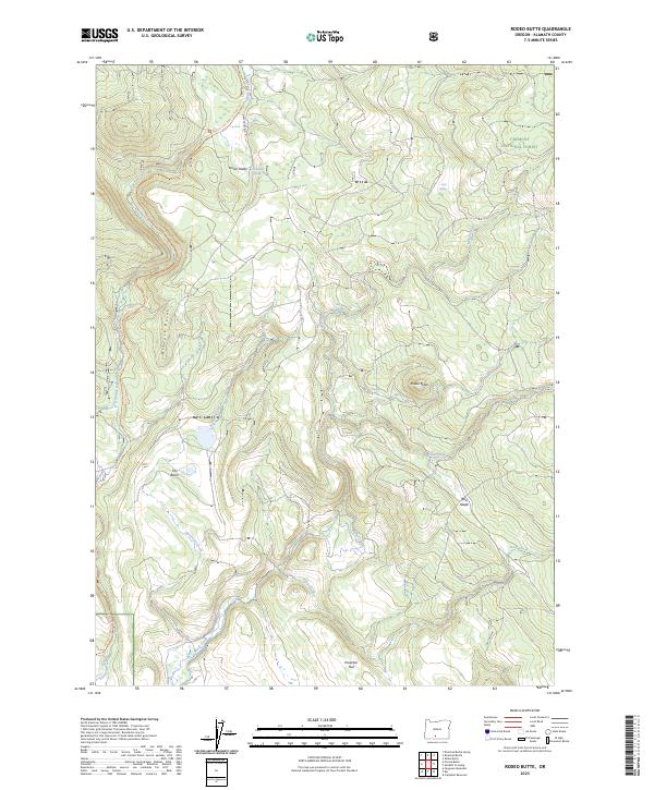
2023 Map of Rodeo Butte
USGS Topo · Published 2023About this map
The Woods Line Rails To Trails Trl winds through the high terrain of Fremont National Forest, preserving the legacy of timber extraction in this part of Klamath County. The landscape is characterized by a series of high-elevation flats and basins, most notably The Basin and Preacher Flat, which sit between prominent rises like Rodeo Butte. The name of the Woods Line itself points to the region's historical reliance on logging railroads to move timber across the plateau. Drainage for the area is provided by Fivmile Creek and Meryl Creek, while reliable water sources like Horse Glade Spring and Meryl Spring served as vital landmarks for those navigating the forest. Historic transition points like Pikes Crossing and the uniquely named Rail Glade suggest a long history of human movement through this backcountry, bridging the gap between early rail routes and contemporary recreational use.
Find a feature on this map
22 named features on this map. Tap any name to fly to it.
Don’t see what you’re looking for? This feature index may not catch every label — zoom into the map to look around manually.
Map Details
Editions of this 2023 Rodeo Butte Map
This is the sole edition of this map. No revisions or reprints were ever made.
Other maps of this area

1889 · Klamath
USGS Topo · 1:250,000

1894 · Klamath
USGS Topo · 1:250,000

1955 · Klamath Falls
USGS Topo · 1:250,000

1958 · Klamath Falls
USGS Topo · 1:250,000

1960 · Riverbed Butte
USGS Topo · 1:62,500

1960 · Bly
USGS Topo · 1:62,500

1960 · Fishhole Mtn
USGS Topo · 1:62,500

1966 · Shake Butte
USGS Topo · 1:24,000

1966 · Sandhill Crossing
USGS Topo · 1:24,000

1974 · Lake Abert
USGS Topo · 1:100,000