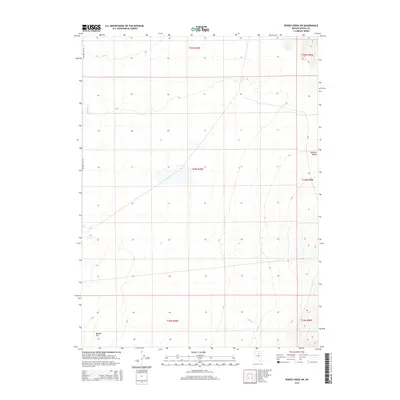
2014 Map of Rodeo Creek SW
USGS Topo · Published 2014About this map
Boulder Flat and Boulder Valley dominate this Great Basin landscape, illustrating the expansive alluvial plains typical of north-central Nevada. The terrain is defined by wide, flat basins that catch the drainage from surrounding ranges, including seasonal flows from Boulder Cr in the northwest and Mack Cr to the southeast. The survey demonstrates a strict land management pattern across Eureka County, with Township and Range lines such as t34n r49e and t35n r50e dividing the open range. Human presence is sparse, represented primarily by the lone corridor of Boulder Flat Rd skirting the western edge, suggesting a landscape largely dedicated to grazing or open resource management rather than dense settlement.
Find a feature on this map
11 named features on this map. Tap any name to fly to it.
Don’t see what you’re looking for? This feature index may not catch every label — zoom into the map to look around manually.
Map Details
Editions of this 2014 Rodeo Creek SW Map
This is the sole edition of this map. No revisions or reprints were ever made.
Other maps of this area

1955 · Winnemucca
USGS Topo · 1:250,000

1957 · Dunphy
USGS Topo · 1:62,500

1957 · Beowawe
USGS Topo · 1:62,500

1958 · Winnemucca
USGS Topo · 1:250,000

1962 · Winnemucca
USGS Topo · 1:250,000

1965 · Sheep Creek Range NE
USGS Topo · 1:24,000

1965 · Sheep Creek Range SE
USGS Topo · 1:24,000

1968 · Rodeo Creek SW
USGS Topo · 1:24,000

1968 · Rodeo Creek NE
USGS Topo · 1:24,000

1968 · Welches Canyon
USGS Topo · 1:24,000