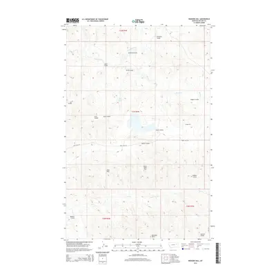
2014 Map of Rodgers Hall
USGS Topo · Published 2014About this map
Rodgers Hall sits at the center of this landscape in McCone County, where the high plains of Eastern Montana are defined by a complex network of coulees and ridges. The drainage of McGuire Cr and its northern fork carve through the northern sections, while the south is marked by the distinct elevations of McDonald Butte and Devils Table Rock. Local landmarks such as Eagle Rock and the Romine Divide provide orientation in this sparsely settled region. Evidence of the area's essential water management appears at School Section Springs, a critical resource for ranching operations in this semi-arid environment. The road network is minimal, primarily consisting of Horse Creek Rd, which serves as a primary east-west artery across the central townships of T21N and T20N.
Find a feature on this map
25 named features on this map. Tap any name to fly to it.
Don’t see what you’re looking for? This feature index may not catch every label — zoom into the map to look around manually.
Map Details
Editions of this 2014 Rodgers Hall Map
This is the sole edition of this map. No revisions or reprints were ever made.
Other maps of this area

1954 · Jordan
USGS Topo · 1:250,000

1954 · Glendive
USGS Topo · 1:250,000

1956 · Jordan
USGS Topo · 1:250,000

1957 · Glendive
USGS Topo · 1:250,000

1958 · Jordan
USGS Topo · 1:250,000

1958 · Glendive
USGS Topo · 1:250,000

1964 · Jordan
USGS Topo · 1:250,000

1973 · Crow Springs
USGS Topo · 1:24,000

1973 · Rodgers Hall
USGS Topo · 1:24,000

1973 · Nelson Creek Bay
USGS Topo · 1:24,000