
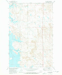
1973 Map of Rodgers Hall
USGS Topo · Published 1977About this map
The Romine Divide segments this high-plains landscape in McCone County, serving as a prominent topographic spine between numerous drainage coulees. This 1973 field-checked survey reveals a territory defined by ranching and resource extraction, where Rodgers Hall stands as the primary namesake landmark. The terrain is marked by distinctive geological formations such as Devils Table Rock, Eagle Rock, and McDonald Butte, which rise above the dissected breaks and coulees.
Find a feature on this map
20 named features on this map. Tap any name to fly to it.
Don’t see what you’re looking for? This feature index may not catch every label — zoom into the map to look around manually.
Map Details
Editions of this 1973 Rodgers Hall Map
This is the sole edition of this map. No revisions or reprints were ever made.
Other maps of this area

1954 · Jordan
USGS Topo · 1:250,000

1954 · Glendive
USGS Topo · 1:250,000

1956 · Jordan
USGS Topo · 1:250,000

1957 · Glendive
USGS Topo · 1:250,000

1958 · Jordan
USGS Topo · 1:250,000

1958 · Glendive
USGS Topo · 1:250,000

1964 · Jordan
USGS Topo · 1:250,000

1973 · Crow Springs
USGS Topo · 1:24,000

1973 · Nelson Creek Bay
USGS Topo · 1:24,000
1973 · Bug Creek
USGS Topo · 1:24,000